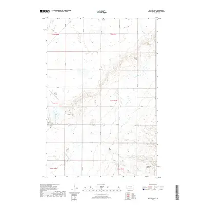
2017 Map of Britton East
USGS Topo · Published 2017About this map
Britton stands at the intersection of a vast agricultural grid and the rising slopes of the Coteau des Prairies. This landscape illustrates the transition from the flat glacial plains to the more textured high plateau of eastern South Dakota. To the east, the terrain becomes increasingly complex as drainage features like Oak Gulch and Wild Rice Cr carve through the rising elevation. The town itself serves as a local hub, supported by the Britton Municipal Airport and surrounded by a dense network of sectional roads like 110th St and Co Rd 6. Throughout the rural sections, localized water bodies such as Gronseth Slough and the Crow Cr watershed define the drainage patterns essential to the region's farming heritage. Genealogy interest may focus on the well-placed Pleasant Hill Cem, located near the northern edge of the plateau.
Find a feature on this map
23 named features on this map. Tap any name to fly to it.
Don’t see what you’re looking for? This feature index may not catch every label — zoom into the map to look around manually.
Map Details
Editions of this 2017 Britton East Map
This is the sole edition of this map. No revisions or reprints were ever made.
Other maps of this area

1953 · Britton East
USGS Topo · 1:24,000

1953 · Kidder
USGS Topo · 1:24,000

1953 · Newark
USGS Topo · 1:24,000

1953 · Milbank
USGS Topo · 1:250,000

1954 · Kidder SE
USGS Topo · 1:24,000

1956 · Havana
USGS Topo · 1:24,000

1956 · Britton West
USGS Topo · 1:24,000

1958 · Milbank
USGS Topo · 1:250,000

1958 · Spain
USGS Topo · 1:24,000

1958 · Britton 4 NW
USGS Topo · 1:24,000