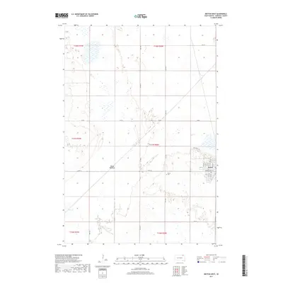
2017 Map of Britton West
USGS Topo · Published 2017About this map
Britton and its western extension, West Britton, serve as the primary hubs in this Marshall County landscape. The survey documents a grid of section lines and rural routes, such as Co Hwy 9 and Co Rd 6, which define the agricultural layout of the region. A dense cluster of residential streets in the eastern portion of the map, including Vander Horck St, reveals the town's local geometry adjacent to the Britton Cem. The terrain is characterized by numerous wetlands and small basins typical of the Glacial Lake Agassiz region, with the winding course of Crow Cr cutting through the southwestern sections. Private landmarks like Max & Peggys Pl suggest the personal history embedded in the land ownership patterns of this prairie community.
Find a feature on this map
28 named features on this map. Tap any name to fly to it.
Don’t see what you’re looking for? This feature index may not catch every label — zoom into the map to look around manually.
Map Details
Editions of this 2017 Britton West Map
This is the sole edition of this map. No revisions or reprints were ever made.
Other maps of this area

1953 · Britton East
USGS Topo · 1:24,000

1953 · Newark SW
USGS Topo · 1:24,000

1953 · Kidder
USGS Topo · 1:24,000

1953 · Newark
USGS Topo · 1:24,000

1953 · Milbank
USGS Topo · 1:250,000

1956 · Britton West
USGS Topo · 1:24,000

1956 · Newark NW
USGS Topo · 1:24,000

1958 · Milbank
USGS Topo · 1:250,000

1958 · Spain
USGS Topo · 1:24,000

1958 · Britton 4 NW
USGS Topo · 1:24,000