
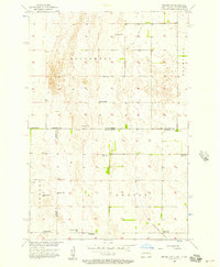
1956 Map of Newark NW
USGS Topo · Published 1957About this map
The North Dakota-South Dakota border country is defined here by the flat, high plains of Sargent County and its transition into Marshall County and Brown County. In the mid-1950s, this landscape was characterized by a sparse, rural infrastructure where water management was critical, evidenced by numerous Flowing Wells scattered across the townships of Southwest, Brampton, Portage, and Dayton. A significant shift in rural life is visible through the transition of its local education system; while School No 1 remained active in the north, many others including School No 2, School No 3, and School No 4 are marked as abandoned. These closures reflect the mid-century trend of rural school consolidation across the Dakotas. Transport is limited to section-line roads and the local Dayton-Stena route, highlighting the isolated, agricultural nature of the region during this period.
Find a feature on this map
15 named features on this map. Tap any name to fly to it.
Don’t see what you’re looking for? This feature index may not catch every label — zoom into the map to look around manually.
Map Details
Editions of this 1956 Newark NW Map
2 editions found
Other maps of this area

1894 · Hecla
USGS Topo · 1:62,500

1894 · Oakes
USGS Topo · 1:62,500

1895 · Lamoure
USGS Topo · 1:125,000

1896 · Columbia
USGS Topo · 1:125,000

1918 · La Moure
USGS Topo · 1:125,000

1953 · Jamestown
USGS Topo · 1:250,000

1953 · Hecla SE
USGS Topo · 1:24,000

1953 · Newark SW
USGS Topo · 1:24,000

1953 · Newark
USGS Topo · 1:24,000

1953 · Milbank
USGS Topo · 1:250,000