1928 Map of Broad Brook
USGS Topo · Published 1928About this map
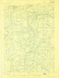
Thompsonville and Warehouse Point anchor the western edge of this 1928 survey, positioned along the banks of the Connecticut River across from Windsor Locks. Compiled from early Air Corps aerial photographs, this map captures the intensive agricultural and industrial landscape of northern Hartford County before modern suburbanization. The interior is defined by a network of rural settlements like Hazardville, Scitico, and Melrose, all linked by the winding course of the Scantic River.
Find a feature on this map
27 named features on this map. Tap any name to fly to it.
Don’t see what you’re looking for? This feature index may not catch every label — zoom into the map to look around manually.
Map Details
Editions of this 1928 Broad Brook Map
This is the sole edition of this map. No revisions or reprints were ever made.
Other maps of this area

1886 · Springfield
USGS Topo · 1:62,500

1887 · Palmer
USGS Topo · 1:62,500

1889 · Springfield
USGS Topo · 1:62,500

1889 · Palmer
USGS Topo · 1:62,500

1892 · Hartford
USGS Topo · 1:62,500

1892 · Tolland
USGS Topo · 1:62,500

1893 · Springfield
USGS Topo · 1:62,500

1893 · Palmer
USGS Topo · 1:62,500

1895 · Springfield
USGS Topo · 1:62,500

1896 · Holyoke
USGS Topo · 1:125,000