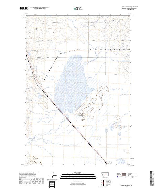
2024 Map of Broadview East
USGS Topo · Published 2024About this map
Comanche Flat dominates this area of Yellowstone County, where the dry landscape is bisected by the seasonal drainage of Comanche Creek. The region is defined by a rigid grid of rural section roads, many bearing family names that reflect the agricultural history of this Montana prairie. In the western portion of the map, the Broadview Cem sits at the junction of Cemetery Rd and Frey Rd, serving as a primary landmark for local genealogical interest. The terrain transitions from the low-lying flats in the center to more varied elevations in the northeast, where the road network becomes less dense. Named routes like Swartz Nelson Rd and David Rd suggest the enduring footprint of long-established ranching or farming families in this high plains environment.
Find a feature on this map
17 named features on this map. Tap any name to fly to it.
Don’t see what you’re looking for? This feature index may not catch every label — zoom into the map to look around manually.
Map Details
Editions of this 2024 Broadview East Map
This is the sole edition of this map. No revisions or reprints were ever made.
Other maps of this area

1954 · Billings
USGS Topo · 1:250,000

1954 · Roundup
USGS Topo · 1:250,000

1956 · Comanche
USGS Topo · 1:24,000

1956 · Acton
USGS Topo · 1:24,000

1956 · Rock Spring
USGS Topo · 1:24,000

1957 · Billings
USGS Topo · 1:250,000

1958 · Billings
USGS Topo · 1:250,000

1958 · Roundup
USGS Topo · 1:250,000

1979 · Roundup
USGS Topo · 1:100,000

1979 · Belmont
USGS Topo · 1:24,000