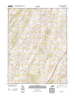
2013 Map of Broadway
USGS Topo · Published 2013About this map
Broadway and its surrounding Shenandoah Valley hamlets are meticulously charted in this early 21st-century record of Rockingham County. The landscape is defined by the winding course of Linville Creek, which is crossed by the Linville Creek Bridge and fed by numerous tributaries like Tide Spring Branch and Cedar Run. Settlement patterns remain clustered around historic nodes such as Turleytown, Edom, and Lacey Spring, while the rural expanse between them is marked by family-named routes like Trissels Road and Klines Mill Road. One of the most distinctive institutional landmarks is the State Prison Camp Number 8, situated near Hightown. This survey provides a precise account of the valley's mix of agricultural land and small aviation infrastructure, notably Joe's Creek Airport, capturing the region's character before further modern expansion could alter the footprint of these long-established communities.
Find a feature on this map
146 named features on this map. Tap any name to fly to it.
Don’t see what you’re looking for? This feature index may not catch every label — zoom into the map to look around manually.
Map Details
Editions of this 2013 Broadway Map
This is the sole edition of this map. No revisions or reprints were ever made.
Other maps of this area

1892 · Woodstock
USGS Topo · 1:125,000

1892 · Harrisonburg
USGS Topo · 1:125,000

1937 · Elkton
USGS Topo · 1:62,500

1941 · Harrisonburg
USGS Topo · 1:62,500

1942 · Mt Jackson
USGS Topo · 1:62,500

1943 · Harrisonburg
USGS Topo · 1:62,500

1946 · Mt Jackson
USGS Topo · 1:62,500

1947 · Mt Jackson
USGS Topo · 1:62,500

1947 · Broadway
USGS Topo · 1:62,500

1949 · Charlottesville
USGS Topo · 1:250,000