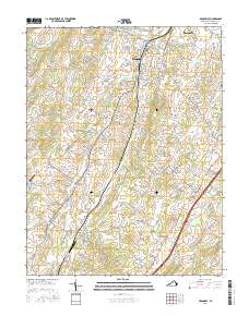
2016 Map of Broadway
USGS Topo · Published 2016About this map
Broadway and Timberville anchor the northern reaches of the Shenandoah Valley in this 2016 study, where the North Fork Shenandoah River winds past established agricultural and residential corridors. The landscape is defined by the parallel courses of Linville Creek and Smith Creek, which frame a series of historic settlements including Lacey Spring, Linville, and Edom. Notable local landmarks like the Linville Creek Bridge and the Linville-Edom Airport highlight the mix of infrastructure and open space. The topography is marked by distinctive features such as Round Hill and the seasonal hydrology of Tide Spring, while the rural character is preserved in named hollows like Simmers Hollow. Numerous family-named roads and sites, such as the Pine Grove Cem, provide specific points of interest for those tracing the development and genealogy of Rockingham County.
Find a feature on this map
119 named features on this map. Tap any name to fly to it.
Don’t see what you’re looking for? This feature index may not catch every label — zoom into the map to look around manually.
Map Details
Editions of this 2016 Broadway Map
This is the sole edition of this map. No revisions or reprints were ever made.
Other maps of this area

1892 · Woodstock
USGS Topo · 1:125,000

1892 · Harrisonburg
USGS Topo · 1:125,000

1937 · Elkton
USGS Topo · 1:62,500

1941 · Harrisonburg
USGS Topo · 1:62,500

1942 · Mt Jackson
USGS Topo · 1:62,500

1943 · Harrisonburg
USGS Topo · 1:62,500

1946 · Mt Jackson
USGS Topo · 1:62,500

1947 · Mt Jackson
USGS Topo · 1:62,500

1947 · Broadway
USGS Topo · 1:62,500

1949 · Charlottesville
USGS Topo · 1:250,000