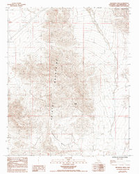
1985 Map of Broadwell Mesa
USGS Topo · Published 1993About this map
Hyten Spring serves as a vital water point in this high-desert landscape, located within the southern reaches of the Bristol Mountains. The terrain is characterized by the prominent elevation of Broadwell Mesa, which dominates the southern portion of the sheet. Surveyed during the late 1970s and early 1980s, the map documents a largely uninhabited expanse defined by its geological formations, including a Natural Arch situated in the southwestern section. The land is strictly partitioned by township and range lines, such as the boundary between T 11 N and T 10 N, reflecting the formal cadastral organization of the Mojave region. This document captures the wilderness prior to modern environmental designations, focusing on the literal relief and drainage patterns of the volcanic and sedimentary features that define the San Bernardino backcountry.
Find a feature on this map
7 named features on this map. Tap any name to fly to it.
Don’t see what you’re looking for? This feature index may not catch every label — zoom into the map to look around manually.
Map Details
Editions of this 1985 Broadwell Mesa Map
2 editions found
Other maps of this area

1910 · Ivanpah
USGS Topo · 1:250,000

1912 · Ivanpah
USGS Topo · 1:250,000

1933 · Avawatz Mountains
USGS Topo · 1:250,000

1942 · Ivanpah
USGS Topo · 1:250,000

1942 · Amboy
USGS Topo · 1:250,000

1943 · Amboy
USGS Topo · 1:250,000

1947 · Trona
USGS Topo · 1:250,000

1947 · Kingman
USGS Topo · 1:250,000

1948 · Kingman
USGS Topo · 1:250,000

1948 · Trona
USGS Topo · 1:250,000