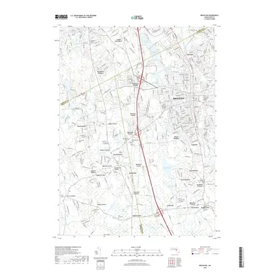
2018 Map of Brockton
USGS Topo · Published 2018About this map
Brockton and its surrounding villages define this 2018 topographic landscape, where the dense street grids of the city transition into the historic hamlets of Bristol and Plymouth counties. The map captures the complex drainage of the region, anchored by the Hockomock Swamp and the headwaters of the Hockomock River, which contrast with the developed residential areas of South Stoughton and Campello. Educational and institutional landmarks like Stonehill College are clearly delineated, alongside numerous community hubs such as Easton Center and Easton Station. Local genealogists will find significant value in the detailed mapping of burial grounds, including Melrose Cem, Saint Patricks Cem, and the Chevra Tillum Cem. The map provides a detailed view of the regional topography, from the elevation of Stonehouse Hill to the winding course of the Salisbury Plain River.
Find a feature on this map
90 named features on this map. Tap any name to fly to it.
Don’t see what you’re looking for? This feature index may not catch every label — zoom into the map to look around manually.
Map Details
Editions of this 2018 Brockton Map
This is the sole edition of this map. No revisions or reprints were ever made.
Other maps of this area

1885 · Abington
USGS Topo · 1:62,500

1885 · Middleboro
USGS Topo · 1:62,500

1885 · Taunton
USGS Topo · 1:62,500

1886 · Dedham
USGS Topo · 1:62,500

1888 · Taunton
USGS Topo · 1:62,500

1888 · Middleboro
USGS Topo · 1:62,500

1888 · Abington
USGS Topo · 1:62,500

1893 · Abington
USGS Topo · 1:62,500

1893 · Taunton
USGS Topo · 1:62,500

1893 · Middleboro
USGS Topo · 1:62,500