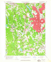
1963 Map of Brockton
USGS Topo · Published 1965About this map
Brockton and its neighboring mill towns and rural corners are caught in a period of significant post-war transition in this 1963 survey. The urban core of Brockton is densely packed with civic infrastructure, including the War Memorial, City Hall, and numerous neighborhood schools like Huntington St Sch and Winthrop Sch. The presence of the U S Veterans Administration Hospital and large greenspaces such as D W Field Park contrast with the industrial legacy represented by the New York New Haven and Hartford Railroad.
Find a feature on this map
134 named features on this map. Tap any name to fly to it.
Don’t see what you’re looking for? This feature index may not catch every label — zoom into the map to look around manually.
Map Details
Editions of this 1963 Brockton Map
This is the sole edition of this map. No revisions or reprints were ever made.
Other maps of this area

1885 · Abington
USGS Topo · 1:62,500

1885 · Middleboro
USGS Topo · 1:62,500

1885 · Taunton
USGS Topo · 1:62,500

1886 · Dedham
USGS Topo · 1:62,500

1888 · Taunton
USGS Topo · 1:62,500

1888 · Middleboro
USGS Topo · 1:62,500

1888 · Abington
USGS Topo · 1:62,500

1893 · Abington
USGS Topo · 1:62,500

1893 · Taunton
USGS Topo · 1:62,500

1893 · Middleboro
USGS Topo · 1:62,500