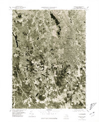
1977 Map of Brockton
USGS Topo · Published 1981About this map
Brockton and its surrounding communities are documented here during a period of significant suburban development in the late 1970s. This orthophotoquad, created from aerial photography taken in April 1977, provides a photographic record of the landscape's density, revealing the transition from the concentrated urban grid of the city center to the expanding residential patterns in Avon and Stoughton. The imagery preserves the physical layout of established neighborhoods and commercial corridors before later decades of further infill.
Find a feature on this map
7 named features on this map. Tap any name to fly to it.
Don’t see what you’re looking for? This feature index may not catch every label — zoom into the map to look around manually.
Map Details
Editions of this 1977 Brockton Map
This is the sole edition of this map. No revisions or reprints were ever made.
Other maps of this area

1885 · Abington
USGS Topo · 1:62,500

1885 · Middleboro
USGS Topo · 1:62,500

1885 · Taunton
USGS Topo · 1:62,500

1886 · Dedham
USGS Topo · 1:62,500

1888 · Taunton
USGS Topo · 1:62,500

1888 · Middleboro
USGS Topo · 1:62,500

1888 · Abington
USGS Topo · 1:62,500

1893 · Abington
USGS Topo · 1:62,500

1893 · Taunton
USGS Topo · 1:62,500

1893 · Middleboro
USGS Topo · 1:62,500