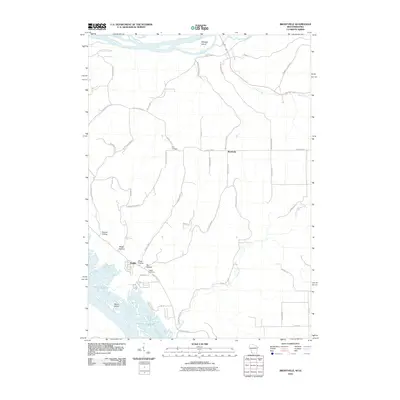
2010 Map of Brodtville
USGS Topo · Published 2010About this map
Bagley and Brodtville anchor this 2010 study of the confluence area where the Wisconsin River meets the Mississippi River. The landscape is defined by its dramatic coulee and ridge topography, with deeply incised valleys like Gasner Hollow, Ready Hollow, and Dry Hollow draining toward the expansive river bottoms. Significant for genealogists, the map identifies Flint Cemetery in the central uplands and Bagley Cemetery near the riverfront. The intricate waterways of the State Line Slough and islands such as Weniger Island and Hovie Island demonstrate the complex hydrology of the Upper Mississippi River valley. Modern transportation is represented by the Great River Rd and a network of county highways that follow the contours of the high ridges, providing a clear view of the rural development patterns in Crawford County during the early 21st century.
Find a feature on this map
44 named features on this map. Tap any name to fly to it.
Don’t see what you’re looking for? This feature index may not catch every label — zoom into the map to look around manually.
Map Details
Editions of this 2010 Brodtville Map
This is the sole edition of this map. No revisions or reprints were ever made.
Other maps of this area

1900 · Lancaster
USGS Topo · 1:125,000

1902 · Elkader
USGS Topo · 1:125,000

1903 · Waukon
USGS Topo · 1:125,000

1904 · Lancaster
USGS Topo · 1:125,000

1908 · Lancaster
USGS Topo · 1:125,000

1926 · Wauzeka
USGS Topo · 1:62,500

1929 · Prairie Du Chien
USGS Topo · 1:62,500

1932 · Prairie Du Chien
USGS Topo · 1:62,500

1958 · La Crosse
USGS Topo · 1:250,000

1959 · Dubuque
USGS Topo · 1:250,000