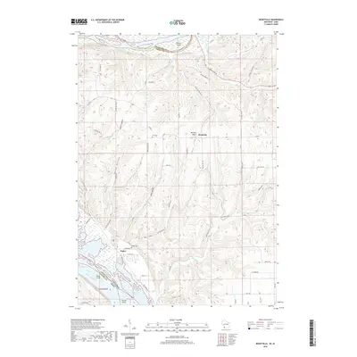
2018 Map of Brodtville
USGS Topo · Published 2018About this map
Bagley and Brodtville sit nestled within the dramatic bluff country where the Wisconsin River meets the Mississippi River at the junction of Wisconsin and Iowa. The landscape is dominated by narrow ridges and deep hollows, such as Military Ridge and Borah Ridge, which guided the early road networks through Crawford and Grant counties. The river bottomlands are a complex network of channels and landforms including Weniger Island, Hovie Island, and State Line Slough. For those tracing local history or family heritage, the map identifies specific rural landmarks like Bagley Cem and Flint Cem, alongside numerous named hollows like Gasner Hollow and Ready Hollow that define the unique topography of this river confluence area. The placement of these features reflects the historical reliance on ridge-top travel and river-access points in this corner of the state.
Find a feature on this map
61 named features on this map. Tap any name to fly to it.
Don’t see what you’re looking for? This feature index may not catch every label — zoom into the map to look around manually.
Map Details
Editions of this 2018 Brodtville Map
This is the sole edition of this map. No revisions or reprints were ever made.
Other maps of this area

1900 · Lancaster
USGS Topo · 1:125,000

1902 · Elkader
USGS Topo · 1:125,000

1903 · Waukon
USGS Topo · 1:125,000

1904 · Lancaster
USGS Topo · 1:125,000

1908 · Lancaster
USGS Topo · 1:125,000

1926 · Wauzeka
USGS Topo · 1:62,500

1929 · Prairie Du Chien
USGS Topo · 1:62,500

1932 · Prairie Du Chien
USGS Topo · 1:62,500

1958 · La Crosse
USGS Topo · 1:250,000

1959 · Dubuque
USGS Topo · 1:250,000