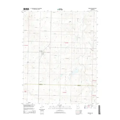
2015 Map of Bronaugh
USGS Topo · Published 2015About this map
Bronaugh serves as the primary hub in this southwest Missouri landscape, where the grid of rural roads meets the winding courses of Prairie Flower Br and Cheney Br. The settlement's layout is clearly defined by local streets such as N Oak St and E 6th St, while the nearby Railroad Pond indicates the town's historical connection to regional transit lines. Further south, the map details the small community of Hannon near the boundary between Vernon and Barton Counties.
Find a feature on this map
62 named features on this map. Tap any name to fly to it.
Don’t see what you’re looking for? This feature index may not catch every label — zoom into the map to look around manually.
Map Details
Editions of this 2015 Bronaugh Map
This is the sole edition of this map. No revisions or reprints were ever made.
Other maps of this area

1884 · Fort Scott
USGS Topo · 1:125,000

1886 · Nevada
USGS Topo · 1:125,000

1886 · Fort Scott
USGS Topo · 1:125,000

1893 · Fort Scott
USGS Topo · 1:125,000

1894 · Nevada
USGS Topo · 1:125,000

1933 · Camp Clark
USGS Topo · 1:24,000

1939 · Deerfield
USGS Topo · 1:24,000

1939 · Moundville
USGS Topo · 1:24,000

1942 · Deerfield
USGS Topo · 1:24,000
1942 · Moundville
USGS Topo · 1:24,000