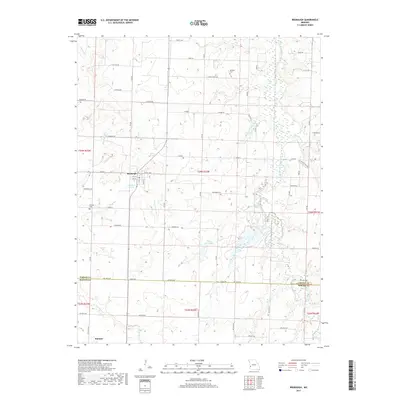
2017 Map of Bronaugh
USGS Topo · Published 2017About this map
Bronaugh sits at the heart of this Western Missouri landscape, where a grid of rural roads connects agricultural sections across the Vernon and Barton County line. The town's layout includes streets like 3rd St and 4th St, with the small Railroad Pond serving as a local landmark. To the south, the settlement of Hannon anchors the lower portion of the map, while the surrounding countryside is dotted with family-named burial sites such as McMullin Cem and Worsley Cem.
Find a feature on this map
43 named features on this map. Tap any name to fly to it.
Don’t see what you’re looking for? This feature index may not catch every label — zoom into the map to look around manually.
Map Details
Editions of this 2017 Bronaugh Map
This is the sole edition of this map. No revisions or reprints were ever made.
Other maps of this area

1884 · Fort Scott
USGS Topo · 1:125,000

1886 · Nevada
USGS Topo · 1:125,000

1886 · Fort Scott
USGS Topo · 1:125,000

1893 · Fort Scott
USGS Topo · 1:125,000

1894 · Nevada
USGS Topo · 1:125,000

1933 · Camp Clark
USGS Topo · 1:24,000

1939 · Deerfield
USGS Topo · 1:24,000

1939 · Moundville
USGS Topo · 1:24,000

1942 · Deerfield
USGS Topo · 1:24,000
1942 · Moundville
USGS Topo · 1:24,000