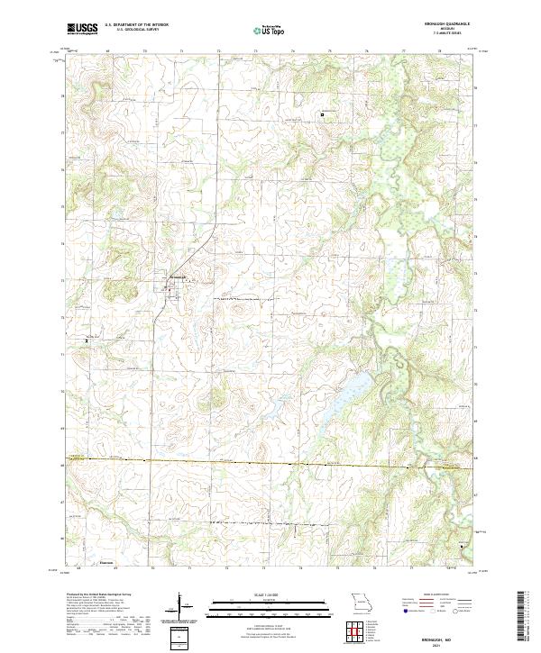
2021 Map of Bronaugh
USGS Topo · Published 2021About this map
Bronaugh sits at the heart of this agricultural landscape in southwestern Missouri, where the Vernon and Barton county line divides the rural countryside. The town’s grid is flanked by a network of named branches and creeks, including Cheney Br and Prairie Flower Br, which drain toward the larger Little Dry Wood Creek in the east. The map reveals a land structured by a strict section-line road system, including named routes like Veteran Rd and Trestle Rd, punctuated by landmarks essential to local history like McMullin Cem and Worsley Cem. Near the southern border, the settlement of Hannon and Bluff Cem provide further evidence of the area's long-standing community footprint. The presence of Finis Moss Lake among the eastern wetlands highlights the transition between the upland prairie farms and the low-lying drainage basins characteristic of this region.
Find a feature on this map
57 named features on this map. Tap any name to fly to it.
Don’t see what you’re looking for? This feature index may not catch every label — zoom into the map to look around manually.
Map Details
Editions of this 2021 Bronaugh Map
This is the sole edition of this map. No revisions or reprints were ever made.
Other maps of this area

1884 · Fort Scott
USGS Topo · 1:125,000

1886 · Nevada
USGS Topo · 1:125,000

1886 · Fort Scott
USGS Topo · 1:125,000

1893 · Fort Scott
USGS Topo · 1:125,000

1894 · Nevada
USGS Topo · 1:125,000

1933 · Camp Clark
USGS Topo · 1:24,000

1939 · Deerfield
USGS Topo · 1:24,000

1939 · Moundville
USGS Topo · 1:24,000

1942 · Deerfield
USGS Topo · 1:24,000
1942 · Moundville
USGS Topo · 1:24,000