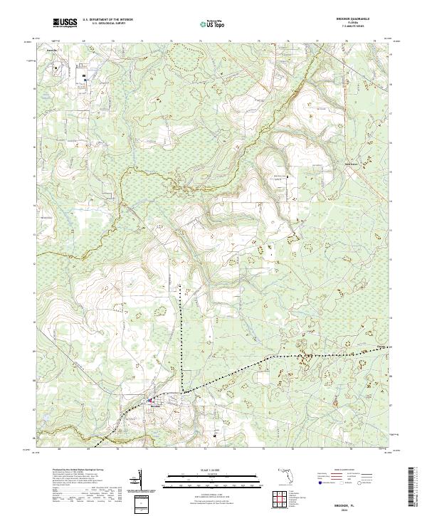
2024 Map of Brooker
USGS Topo · Published 2024About this map
Brooker serves as a primary hub in this corner of Bradford County, situated just north of the Santa Fe River. The landscape is defined by the winding course of the New River, which forms a significant natural boundary and provides drainage through numerous tributaries like Lake Butler Creek and McKinney Branch. Low-lying areas such as Mud Swamp and Dekles Millpond suggest a region shaped by its proximity to the river system and local agricultural history. Small rural settlements like Danville and Clayno are linked by a network of county roads including Co RD 231. Local family and community history is preserved at the New River Cem and Dedan Cem, which remain as key landmarks in this largely rural expanse where the borders of Union, Bradford, and Alachua counties meet.
Find a feature on this map
110 named features on this map. Tap any name to fly to it.
Don’t see what you’re looking for? This feature index may not catch every label — zoom into the map to look around manually.
Map Details
Editions of this 2024 Brooker Map
This is the sole edition of this map. No revisions or reprints were ever made.
Other maps of this area

1918 · Lawtey
USGS Topo · 1:62,500

1941 · Starke
USGS Topo · 1:62,500

1948 · Starke
USGS Topo · 1:50,000

1949 · Sampson
USGS Topo · 1:24,000

1949 · Waldo
USGS Topo · 1:24,000

1949 · Starke
USGS Topo · 1:62,500

1954 · Gainesville
USGS Topo · 1:250,000

1954 · Valdosta
USGS Topo · 1:250,000

1958 · Valdosta
USGS Topo · 1:250,000

1958 · Gainesville
USGS Topo · 1:250,000