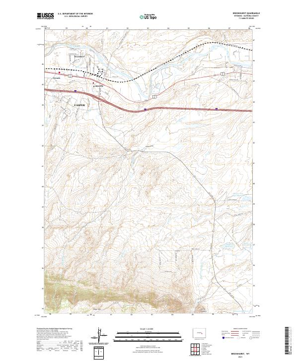
2021 Map of Brookhurst
USGS Topo · Published 2021About this map
The North Platte River flows through the northern reaches of this Natrona County landscape, anchoring a corridor of historical development and infrastructure. The industrial and residential expansion of Evansville and Brookhurst is evident along the river's south bank, while the eastern fringes of Casper appear near the Elkhorn Cr drainage. To the south, the topography transitions toward the prominent rising slopes of Casper Mtn, punctuated by the distinctive Hat Six Hogback. This 2021 survey details a complex network of ranching roads and water management features, including Wagner and Bayer Reservoir and Steed Reservoir, which support the agricultural life of the plains. The map traces the winding paths of Goose Cr and Dry Muddy Cr, reflecting the vital relationship between the high desert terrain and its limited water resources.
Find a feature on this map
66 named features on this map. Tap any name to fly to it.
Don’t see what you’re looking for? This feature index may not catch every label — zoom into the map to look around manually.
Map Details
Editions of this 2021 Brookhurst Map
This is the sole edition of this map. No revisions or reprints were ever made.
Other maps of this area

1949 · Brookhurst
USGS Topo · 1:24,000

1949 · Campbell Hill
USGS Topo · 1:24,000

1949 · Pratts Soda Lakes
USGS Topo · 1:24,000

1950 · Campbell Hill
USGS Topo · 1:24,000

1950 · Lockett
USGS Topo · 1:24,000

1950 · Brookhurst
USGS Topo · 1:24,000

1950 · Pratts Soda Lakes
USGS Topo · 1:24,000

1951 · The Reefs
USGS Topo · 1:24,000

1951 · Casper
USGS Topo · 1:24,000

1955 · Casper
USGS Topo · 1:250,000