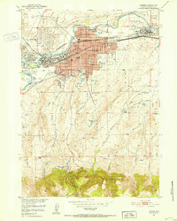
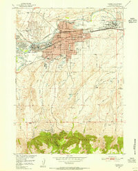
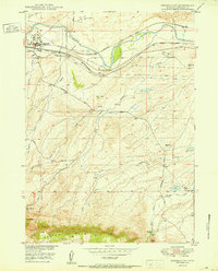
1951 Map of Casper
USGS Topo · Published 1952About this map
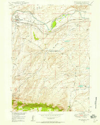
The industrial and civic heart of Casper is defined here by its relationship with the North Platte River and a massive infrastructure of petroleum storage and transportation. Extensive Oil Tank Farms and pipe lines dominate the northern landscape, reflecting the city’s mid-century role as a regional energy hub. Along the river's southern banks, the community's heritage is anchored by the Ft Casper Historical Grounds and the Izaak Walton Park, while the city’s upward expansion is visible in newer residential tracts like Thorndale Acres and Allendale near the base of the looming Casper Mountain.
Find a feature on this map
59 named features on this map. Tap any name to fly to it.
Don’t see what you’re looking for? This feature index may not catch every label — zoom into the map to look around manually.
Map Details
Editions of this 1951 Casper Map
2 editions found
Other maps of this area
1949 · Brookhurst
USGS Topo · 1:24,000
1949 · Pratts Soda Lakes
USGS Topo · 1:24,000
1950 · Brookhurst
USGS Topo · 1:24,000

1950 · Pratts Soda Lakes
USGS Topo · 1:24,000

1950 · Goose Egg
USGS Topo · 1:24,000

1951 · The Reefs
USGS Topo · 1:24,000
1952 · Bishop
USGS Topo · 1:24,000

1955 · Casper
USGS Topo · 1:250,000

1958 · Casper
USGS Topo · 1:250,000
1960 · Bishop
USGS Topo · 1:24,000