
1950 Map of Goose Egg
USGS Topo · Published 1952About this map
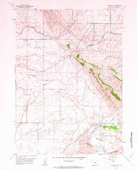
Casper Mountain dominates the southern landscape of this mid-century survey, rising sharply above the winding North Platte River. The settlement of Mountain View serves as a focal point for infrastructure near the river's bend, where the Chicago and Northwestern and Chicago Burlington and Quincy railroads converge. This corridor was a vital transit hub, evidenced by the presence of Miller Spur and a network of irrigation ditches and pipelines servicing the surrounding basin.
Find a feature on this map
22 named features on this map. Tap any name to fly to it.
Don’t see what you’re looking for? This feature index may not catch every label — zoom into the map to look around manually.
Map Details
Editions of this 1950 Goose Egg Map
This is the sole edition of this map. No revisions or reprints were ever made.
Other maps of this area

1950 · Emigrant Gap
USGS Topo · 1:24,000

1950 · Emigrant Gap NE
USGS Topo · 1:24,000

1951 · The Reefs
USGS Topo · 1:24,000

1951 · Casper
USGS Topo · 1:24,000

1951 · Bessemer Mountain
USGS Topo · 1:24,000

1952 · Bishop
USGS Topo · 1:24,000

1955 · Casper
USGS Topo · 1:250,000

1958 · Casper
USGS Topo · 1:250,000
1960 · Emigrant Gap
USGS Topo · 1:24,000
1960 · Bishop
USGS Topo · 1:24,000