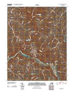
2010 Map of Brookneal
USGS Topo · Published 2010About this map
The Roanoke River and its major tributary, the Falling River, define the landscape south of the historic crossroads at Brookneal. This 2010 survey details the complex network of creeks and branches that feed these waterways, including Hickory Creek, Dog Creek, and Childrey Creek. The mapping reveals a mixture of established rural settlements like Naruna and North Halifax alongside industrial and recreational infrastructure such as the Brookneal Reservoir and Camp Hat Creek. Local genealogists will find several family-named landmarks and burial sites, including the Wickliff-Rush Cemetery, Henry Cemetery, and the notable Red Hill property at Patrick Henry. The geography is further marked by legacy transit points like Holts Crossing and small community hubs such as Martins Store, illustrating the transition of Campbell County from traditional agricultural use to contemporary water management and preservation.
Find a feature on this map
68 named features on this map. Tap any name to fly to it.
Don’t see what you’re looking for? This feature index may not catch every label — zoom into the map to look around manually.
Map Details
Editions of this 2010 Brookneal Map
This is the sole edition of this map. No revisions or reprints were ever made.
Other maps of this area

1892 · Lynchburg
USGS Topo · 1:125,000

1892 · Appomattox
USGS Topo · 1:125,000

1947 · Roanoke
USGS Topo · 1:250,000

1953 · Greensboro
USGS Topo · 1:250,000

1954 · Greensboro
USGS Topo · 1:250,000

1954 · Halifax
USGS Topo · 1:62,500

1954 · Riceville
USGS Topo · 1:62,500

1956 · Brookneal
USGS Topo · 1:62,500

1956 · Gladys
USGS Topo · 1:62,500

1959 · Roanoke
USGS Topo · 1:250,000