
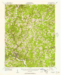
1956 Map of Brookneal
USGS Topo · Published 1957About this map
The Staunton River and Falling River converge at Brookneal, a critical junction in Virginia's southern Piedmont. This mid-century landscape is defined by its deep historical roots and rural infrastructure, most notably Red Hill (Home of Patrick Henry), the final home of the revolutionary orator. The map documents a dense network of local landmarks, including the Bradley Sch and Hancock Sch, alongside numerous country churches like Providence Ch and Beulah Ch.
Find a feature on this map
89 named features on this map. Tap any name to fly to it.
Don’t see what you’re looking for? This feature index may not catch every label — zoom into the map to look around manually.
Map Details
Editions of this 1956 Brookneal Map
2 editions found
Other maps of this area

1892 · Lynchburg
USGS Topo · 1:125,000

1892 · Appomattox
USGS Topo · 1:125,000

1944 · Lynchburg
USGS Topo · 1:62,500

1947 · Roanoke
USGS Topo · 1:250,000

1950 · Lynchburg
USGS Topo · 1:62,500

1953 · Greensboro
USGS Topo · 1:250,000

1954 · Greensboro
USGS Topo · 1:250,000

1954 · Clover
USGS Topo · 1:62,500

1954 · Halifax
USGS Topo · 1:62,500

1954 · Riceville
USGS Topo · 1:62,500