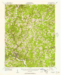
1956 Map of Brookneal
USGS Topo · Published 1957About this map
Red Hill, the final residence and burial place of the Revolutionary orator, anchors the southern landscape of this 1950s survey where Campbell and Charlotte counties meet. The area is defined by the winding course of the Staunton River and its confluence with the Falling River near the town of Brookneal. This period reveals a landscape transitioning through mid-century infrastructure, featuring the Virginian and Norfolk and Western railroads alongside early automotive landmarks like a Drive-in Theater and a Landing Strip.
Find a feature on this map
75 named features on this map. Tap any name to fly to it.
Don’t see what you’re looking for? This feature index may not catch every label — zoom into the map to look around manually.
Map Details
Editions of this 1956 Brookneal Map
2 editions found

Other maps of this area

1892 · Lynchburg
USGS Topo · 1:125,000

1892 · Appomattox
USGS Topo · 1:125,000

1944 · Lynchburg
USGS Topo · 1:62,500

1947 · Roanoke
USGS Topo · 1:250,000

1950 · Lynchburg
USGS Topo · 1:62,500

1953 · Greensboro
USGS Topo · 1:250,000

1954 · Greensboro
USGS Topo · 1:250,000

1954 · Clover
USGS Topo · 1:62,500

1954 · Halifax
USGS Topo · 1:62,500

1954 · Riceville
USGS Topo · 1:62,500