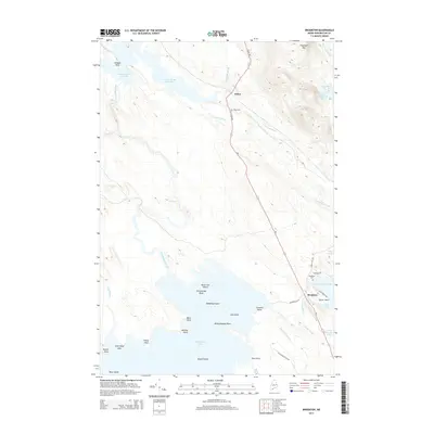
2014 Map of Brookton
USGS Topo · Published 2014About this map
Baskahegan Lake and its intricate northern shoreline dominate this portion of Washington County, where the transition from water to timberland defines the local geography. The settlement of Brookton sits at a strategic junction near Jackson Brook Lake, serving as a primary hub along the Us-1 corridor. Further north, the smaller community of Eaton is nestled between Witcher Brook and the winding S Crooked Brook.
Find a feature on this map
48 named features on this map. Tap any name to fly to it.
Don’t see what you’re looking for? This feature index may not catch every label — zoom into the map to look around manually.
Map Details
Editions of this 2014 Brookton Map
This is the sole edition of this map. No revisions or reprints were ever made.
Other maps of this area

1940 · Danforth
USGS Topo · 1:62,500

1940 · Waite
USGS Topo · 1:62,500

1940 · Forest
USGS Topo · 1:62,500

1941 · Danforth
USGS Topo · 1:62,500

1941 · Scraggly Lake
USGS Topo · 1:62,500

1942 · Waite
USGS Topo · 1:62,500

1942 · Forest
USGS Topo · 1:62,500

1943 · Danforth
USGS Topo · 1:62,500

1944 · Scraggly Lake
USGS Topo · 1:62,500

1957 · Fredericton
USGS Topo · 1:250,000