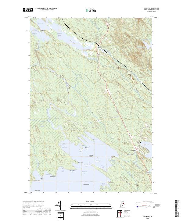
2024 Map of Brookton
USGS Topo · Published 2024About this map
Baskahegan Lake dominates the southern landscape of this Washington County survey, its complex shoreline defined by numerous points and coves like Abraquidassat Point and Knownothing Cove. The interior Maine topography is characterized by extensive wetlands, including Webber Bog and Anvil Meadow, which feed into the meandering Baskahegan Stream. The settlement pattern centers on the village of Brookton and the smaller community of Eaton to the north, both situated along the historic corridor of Calais Rd. Genealogists will find the Brookton Cem and Eaton Cem clearly marked near these old town sites. Further north, the elevation rises toward Flagstaff Mtn, while the waters of Witcher Brook and Crooked Brook Flowage suggest the intricate drainage systems that historically supported the region's timber and water-powered industries. Unique place names like Hell Rapids and Dung Fork Points add local character to this detailed view of the rural borderlands.
Find a feature on this map
61 named features on this map. Tap any name to fly to it.
Don’t see what you’re looking for? This feature index may not catch every label — zoom into the map to look around manually.
Map Details
Editions of this 2024 Brookton Map
This is the sole edition of this map. No revisions or reprints were ever made.
Other maps of this area

1940 · Danforth
USGS Topo · 1:62,500

1940 · Waite
USGS Topo · 1:62,500

1940 · Forest
USGS Topo · 1:62,500

1941 · Danforth
USGS Topo · 1:62,500

1941 · Scraggly Lake
USGS Topo · 1:62,500

1942 · Waite
USGS Topo · 1:62,500

1942 · Forest
USGS Topo · 1:62,500

1943 · Danforth
USGS Topo · 1:62,500

1944 · Scraggly Lake
USGS Topo · 1:62,500

1957 · Fredericton
USGS Topo · 1:250,000