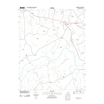
2011 Map of Brosville
USGS Topo · Published 2011About this map
The Dan River winds across this Pittsylvania County landscape, defining the topography between the settlements of Bachelors Hall and Brosville. In this early 21st-century survey, the rural character of the region is evident through its numerous family-named peaks and cemeteries. Terrain features like Perkins Mountain, Soyar Mountain, and Judy Byrd Mountain rise above the drainage basins of Trotters Creek and Williamson Creek. For those tracing local heritage, the map identifies several burial grounds including Scearce Gammon Cemetery near Callahans Hills and Soyar Cemetery just north of the mountain bearing the same name. Small community centers such as Vandola, Mayfield, and Hickory Grove are connected by a network of local routes like Chandler Mill Rd and Dibrell Rd, illustrating the persistent residential patterns in this part of southern Virginia.
Find a feature on this map
93 named features on this map. Tap any name to fly to it.
Don’t see what you’re looking for? This feature index may not catch every label — zoom into the map to look around manually.
Map Details
Editions of this 2011 Brosville Map
This is the sole edition of this map. No revisions or reprints were ever made.
Other maps of this area

1923 · Danville
USGS Topo · 1:48,000

1924 · Draper
USGS Topo · 1:48,000

1925 · Danville
USGS Topo · 1:62,500

1926 · Draper
USGS Topo · 1:62,500

1944 · Draper
USGS Topo · 1:62,500

1953 · Greensboro
USGS Topo · 1:250,000

1954 · Greensboro
USGS Topo · 1:250,000

1962 · Greensboro
USGS Topo · 1:250,000

1964 · Mount Hermon
USGS Topo · 1:24,000

1965 · Danville
USGS Topo · 1:24,000