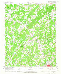
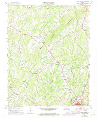
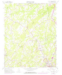
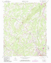
1964 Map of Mount Hermon
USGS Topo · Published 1966About this map
White Oak Mountain dominates the northern landscape of this mid-1960s study, creating a natural divide between the agricultural valleys of Sandy Creek and the drainage of White Oak Creek. The area north of Danville reveals a network of rural communities and institutions, from the Mount Hermon School to the prominent Hughes Memorial School near the city limit. Industrial and transit footprints are clearly visible where the Southern Railway runs through Blairs, contrasting with the legacy paths like the Old Grade Railroad. Notable for local history and genealogy, the map identifies numerous family and community landmarks, including Laniers Mill on Dry Fork, several country churches like Hopewell Church and Fleemon Church, and the expansive Highland Burial Park at the edge of the growing New Design district.
Find a feature on this map
39 named features on this map. Tap any name to fly to it.
Don’t see what you’re looking for? This feature index may not catch every label — zoom into the map to look around manually.
Map Details
Editions of this 1964 Mount Hermon Map
4 editions found
Other maps of this area

1921 · Chatham
USGS Topo · 1:48,000

1922 · Callands
USGS Topo · 1:48,000

1923 · Danville
USGS Topo · 1:48,000

1923 · Chatham
USGS Topo · 1:62,500

1924 · Draper
USGS Topo · 1:48,000

1924 · Callands
USGS Topo · 1:62,500

1925 · Danville
USGS Topo · 1:62,500

1926 · Draper
USGS Topo · 1:62,500

1944 · Draper
USGS Topo · 1:62,500

1944 · Callands
USGS Topo · 1:62,500