1964 Map of Mount Hermon
USGS Topo · Published 1986About this map
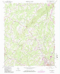
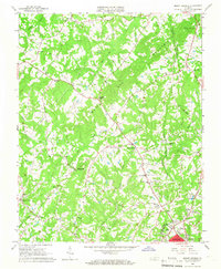
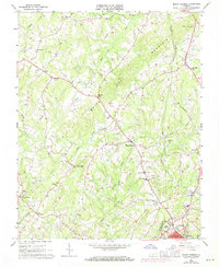
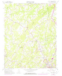
White Oak Mountain dominates the central landscape of this quadrangle, shaping the drainage patterns for Sandy Creek and the Little Sandy Creek that flow toward the outskirts of Danville. The map records a rural Piedmont community defined by its crossroads and water-powered history, notably at Laniers Mill and Pleasant Gap. The Southern Railroad runs through the eastern portion of the sheet, connecting settlements like Blairs and Witt to the industrial hub of Danville. This 1960s-era topography, later updated in the mid-1980s, reveals a network of country churches such as the Church of Truth and Gilfield Ch, alongside educational landmarks like the Mount Hermon Sch. The transition from agrarian land use to suburban development is evident as one moves south toward the city limits and the Highland Burial Park.
Find a feature on this map
39 named features on this map. Tap any name to fly to it.
Don’t see what you’re looking for? This feature index may not catch every label — zoom into the map to look around manually.
Map Details
Editions of this 1964 Mount Hermon Map
4 editions found
Other maps of this area

1921 · Chatham
USGS Topo · 1:48,000

1922 · Callands
USGS Topo · 1:48,000

1923 · Danville
USGS Topo · 1:48,000

1923 · Chatham
USGS Topo · 1:62,500

1924 · Draper
USGS Topo · 1:48,000

1924 · Callands
USGS Topo · 1:62,500

1925 · Danville
USGS Topo · 1:62,500

1926 · Draper
USGS Topo · 1:62,500

1944 · Draper
USGS Topo · 1:62,500

1944 · Callands
USGS Topo · 1:62,500