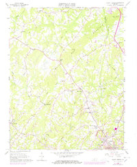
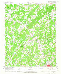
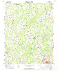
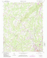
1964 Map of Mount Hermon
USGS Topo · Published 1978About this map
White Oak Mountain anchors the center of this landscape, a prominent ridge that shapes the settlement patterns between the growing city of Danville and the rural stretches of Pittsylvania County. By the mid-1960s, suburban expansion from the south is evident near New Design and Lima, while established agricultural crossroads like Mount Hermon and Pleasant Gap maintain their rural character. The map captures a transitional era for local infrastructure, documenting the Southern Railroad corridor alongside historic community centers like Laniers Mill and Mount Hermon School.
Find a feature on this map
33 named features on this map. Tap any name to fly to it.
Don’t see what you’re looking for? This feature index may not catch every label — zoom into the map to look around manually.
Map Details
Editions of this 1964 Mount Hermon Map
4 editions found
Other maps of this area

1921 · Chatham
USGS Topo · 1:48,000

1922 · Callands
USGS Topo · 1:48,000

1923 · Danville
USGS Topo · 1:48,000

1923 · Chatham
USGS Topo · 1:62,500

1924 · Draper
USGS Topo · 1:48,000

1924 · Callands
USGS Topo · 1:62,500

1925 · Danville
USGS Topo · 1:62,500

1926 · Draper
USGS Topo · 1:62,500

1944 · Draper
USGS Topo · 1:62,500

1944 · Callands
USGS Topo · 1:62,500