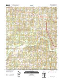
2013 Map of Brosville
USGS Topo · Published 2013About this map
The Dan River winds through this Piedmont landscape, forming a natural boundary near the Virginia and North Carolina border. The area is defined by a series of small, established communities including Brosville, Bachelors Hall, and Vandola, many of which grew along the road networks branching out from the river valley. The terrain is marked by prominent elevations such as Perkins Mountain, Soyar Mountain, and Judy Byrd Mountain, which overlook the surrounding creeks and branches.
Find a feature on this map
121 named features on this map. Tap any name to fly to it.
Don’t see what you’re looking for? This feature index may not catch every label — zoom into the map to look around manually.
Map Details
Editions of this 2013 Brosville Map
This is the sole edition of this map. No revisions or reprints were ever made.
Other maps of this area

1923 · Danville
USGS Topo · 1:48,000

1924 · Draper
USGS Topo · 1:48,000

1925 · Danville
USGS Topo · 1:62,500

1926 · Draper
USGS Topo · 1:62,500

1944 · Draper
USGS Topo · 1:62,500

1953 · Greensboro
USGS Topo · 1:250,000

1954 · Greensboro
USGS Topo · 1:250,000

1962 · Greensboro
USGS Topo · 1:250,000

1964 · Mount Hermon
USGS Topo · 1:24,000

1965 · Danville
USGS Topo · 1:24,000