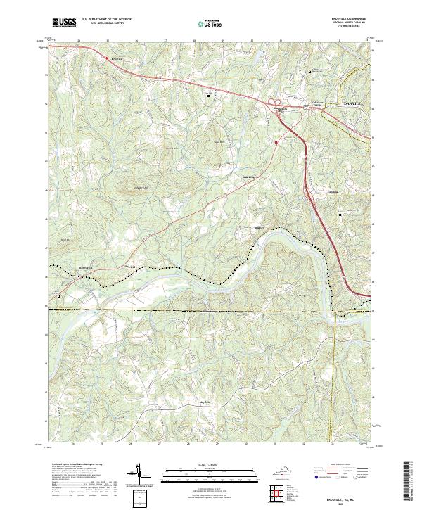
2022 Map of Brosville
USGS Topo · Published 2022About this map
The Dan River carves a winding path across the state line between Virginia and North Carolina, defining the rural character of this borderland. The topography is shaped by a series of distinct peaks including Perkins Mtn, Soyar Mtn, and Judy Byrd Mtn, which overlook a network of small agricultural and residential settlements. The village of Brosville sits in the northwest, while Bachelors Hall and the edges of Danville occupy the northeastern corner near the Sandy River. Family history is deeply rooted in the landscape, evidenced by numerous small burial grounds such as the Scarce Gammon Cem, Moss Cem, and Soyar Cem. The transition from the hills of Pittsylvania County into the flatter terrain of Rockingham and Caswell Counties is marked by the presence of Mayfield and the banks of Wolf Island Creek to the south.
Find a feature on this map
114 named features on this map. Tap any name to fly to it.
Don’t see what you’re looking for? This feature index may not catch every label — zoom into the map to look around manually.
Map Details
Editions of this 2022 Brosville Map
This is the sole edition of this map. No revisions or reprints were ever made.
Other maps of this area

1923 · Danville
USGS Topo · 1:48,000

1924 · Draper
USGS Topo · 1:48,000

1925 · Danville
USGS Topo · 1:62,500

1926 · Draper
USGS Topo · 1:62,500

1944 · Draper
USGS Topo · 1:62,500

1953 · Greensboro
USGS Topo · 1:250,000

1954 · Greensboro
USGS Topo · 1:250,000

1962 · Greensboro
USGS Topo · 1:250,000

1964 · Mount Hermon
USGS Topo · 1:24,000

1965 · Danville
USGS Topo · 1:24,000