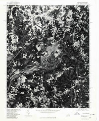
1977 Map of Brosville
USGS Topo · Published 1979About this map
Dan River curves through the center of this 1970s orthophotoquad, defining a landscape of dense woodlands and geometric agricultural clearings along the Virginia and North Carolina border. This unique aerial perspective shows the settlement patterns of Brosville and Bachelors Hall as they appeared in the late twentieth century, with road networks connecting small rural communities like Oak Ridge, Vandola, and Buford. The imagery provides a raw look at land use, revealing the exact footprint of homesteads and the winding course of the Sandy River as it feeds into the larger waterway. South of the river, Mayfield stands as a prominent point of interest for those studying the borderland geography between Pittsylvania County and the neighboring North Carolina territory. The map is a product of cooperation between the USGS and the North Carolina Department of Natural and Community Development.
Find a feature on this map
8 named features on this map. Tap any name to fly to it.
Don’t see what you’re looking for? This feature index may not catch every label — zoom into the map to look around manually.
Map Details
Editions of this 1977 Brosville Map
This is the sole edition of this map. No revisions or reprints were ever made.
Other maps of this area

1923 · Danville
USGS Topo · 1:48,000

1924 · Draper
USGS Topo · 1:48,000

1925 · Danville
USGS Topo · 1:62,500

1926 · Draper
USGS Topo · 1:62,500

1944 · Draper
USGS Topo · 1:62,500

1953 · Greensboro
USGS Topo · 1:250,000

1954 · Greensboro
USGS Topo · 1:250,000

1962 · Greensboro
USGS Topo · 1:250,000

1964 · Mount Hermon
USGS Topo · 1:24,000

1965 · Danville
USGS Topo · 1:24,000