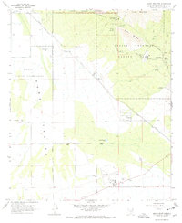
1968 Map of Brown Mountain
USGS Topo · Published 1970About this map
The Tucson Mountain Park and the western edge of the Tucson Mountains dominate this late-1960s survey of Pima County. The map captures a unique intersection of authentic Sonoran desert and cultural recreations, most notably the Old Tucson movie set and the Arizona-Sonora Desert Museum. These landmarks sit at the edge of the rugged mountain terrain, transitioning westward into the broad Avra Valley.
Find a feature on this map
33 named features on this map. Tap any name to fly to it.
Don’t see what you’re looking for? This feature index may not catch every label — zoom into the map to look around manually.
Map Details
Editions of this 1968 Brown Mountain Map
3 editions found
Other maps of this area

1925 · San Xavier
USGS Topo · 1:62,500

1934 · Tucson Mountains
USGS Topo · 1:125,000

1941 · Cocoraque Butte
USGS Topo · 1:62,500

1943 · Cocoraque Butte
USGS Topo · 1:62,500

1943 · San Xavier Mission
USGS Topo · 1:62,500

1947 · Cortaro
USGS Topo · 1:62,500

1956 · Tucson
USGS Topo · 1:250,000

1957 · San Xavier Mission
USGS Topo · 1:62,500

1957 · Cortaro
USGS Topo · 1:62,500

1958 · Tucson
USGS Topo · 1:250,000