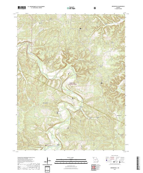
2021 Map of Brownfield
USGS Topo · Published 2021About this map
The Gasconade River snakes through the heart of this terrain, defining the boundary between Pulaski and Laclede counties. The landscape is characterized by its deep hollows and family-named landmarks, such as Rollins Cem and Nicks Cem, which offer significant genealogical value for those tracing local history. The settlement of Brownfield sits near the namesake Brownfield Cem, while the rugged geography is further detailed by features like Laquey Hollow and Flatrock Hollow. Extensive portions of the Mark Twain National Forest cover the area, preserving the wooded character of the Ozarks. Smaller watercourses like Roubidoux Cr and Cole Cr feed into the larger river system, reflecting a classic Missouri drainage pattern. This survey provides a modern snapshot of the region's rural infrastructure, from State Hwy AB to the crossing at Adam Ford.
Find a feature on this map
34 named features on this map. Tap any name to fly to it.
Don’t see what you’re looking for? This feature index may not catch every label — zoom into the map to look around manually.
Map Details
Editions of this 2021 Brownfield Map
This is the sole edition of this map. No revisions or reprints were ever made.
Other maps of this area

1936 · Waynesville
USGS Topo · 1:48,000

1941 · Big Piney
USGS Topo · 1:62,500

1942 · Waynesville
USGS Topo · 1:62,500

1943 · Richland
USGS Topo · 1:62,500

1943 · Big Piney
USGS Topo · 1:62,500

1943 · Drynob
USGS Topo · 1:62,500

1944 · Waynesville
USGS Topo · 1:62,500

1954 · Springfield
USGS Topo · 1:250,000

1954 · Drynob
USGS Topo · 1:62,500
1954 · Big Piney
USGS Topo · 1:62,500