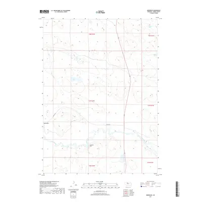
2017 Map of Brownlee
USGS Topo · Published 2017About this map
Brownlee serves as the primary settlement within this section of the Nebraska Sandhills, situated where the meandering North Loup River carves through the undulating landscape. The region's unique hydrology is well-documented, showing a complex network of wetlands including Alkali Lake and O'Brien Lake to the north. These features, alongside Chamberlain Swamp and Reiser-Shockley Swamp, suggest a landscape shaped by high water tables and seasonal shifts. The presence of Hackberry Point provides a rare named topographical landmark in an area otherwise defined by subtle shifts in elevation. Modern infrastructure is limited, centered primarily on Brownlee Rd, which connects the small community to the surrounding ranching country. This map captures the intersection of traditional Sandhills water features and the established township grid in Cherry County.
Find a feature on this map
14 named features on this map. Tap any name to fly to it.
Don’t see what you’re looking for? This feature index may not catch every label — zoom into the map to look around manually.
Map Details
Editions of this 2017 Brownlee Map
This is the sole edition of this map. No revisions or reprints were ever made.
Other maps of this area

1948 · Seneca 4
USGS Topo · 1:62,500

1949 · Seneca 4
USGS Topo · 1:62,500

1949 · Purdum
USGS Topo · 1:62,500

1949 · Long Lake
USGS Topo · 1:62,500

1951 · Long Lake
USGS Topo · 1:62,500

1951 · Purdum
USGS Topo · 1:62,500

1951 · Brownlee
USGS Topo · 1:62,500

1957 · Valentine
USGS Topo · 1:250,000

1959 · Valentine
USGS Topo · 1:250,000

1985 · Long Lake
USGS Topo · 1:24,000