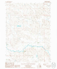
1985 Map of Brownlee
USGS Topo · Published 1986About this map
The North Loup River meanders through the heart of this Cherry County landscape, defining the local topography and settlement patterns of the mid-1980s. The small community of Brownlee sits near the river's edge in the southwest, accompanied by a local Cem. The surrounding terrain is characterized by a sparse network of ranching operations that testify to the enduring cattle-rearing traditions of the Sandhills region.
Find a feature on this map
14 named features on this map. Tap any name to fly to it.
Don’t see what you’re looking for? This feature index may not catch every label — zoom into the map to look around manually.
Map Details
Editions of this 1985 Brownlee Map
This is the sole edition of this map. No revisions or reprints were ever made.
Other maps of this area

1948 · Seneca 4
USGS Topo · 1:62,500

1949 · Seneca 4
USGS Topo · 1:62,500

1949 · Purdum
USGS Topo · 1:62,500

1949 · Long Lake
USGS Topo · 1:62,500

1951 · Long Lake
USGS Topo · 1:62,500

1951 · Purdum
USGS Topo · 1:62,500

1951 · Brownlee
USGS Topo · 1:62,500

1957 · Valentine
USGS Topo · 1:250,000

1959 · Valentine
USGS Topo · 1:250,000

1985 · Long Lake
USGS Topo · 1:24,000