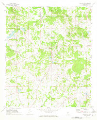
1971 Map of Brownsville
USGS Topo · Published 1973About this map
Brownsville and its surrounding countryside in Hinds County are documented here as they appeared in the early 1970s. This agricultural and wooded landscape is defined by the winding course of Bogue Falia and Cox Creek, with several small water bodies like White Lake and Williams Lake dotting the terrain. The map highlights a network of rural roads such as Northside Drive and Orange Road that connect scattered family farms and community centers.
Find a feature on this map
26 named features on this map. Tap any name to fly to it.
Don’t see what you’re looking for? This feature index may not catch every label — zoom into the map to look around manually.
Map Details
Editions of this 1971 Brownsville Map
This is the sole edition of this map. No revisions or reprints were ever made.
Other maps of this area

1903 · Jackson
USGS Topo · 1:125,000

1934 · Raymond
USGS Topo · 1:48,000

1937 · Raymond
USGS Topo · 1:62,500

1938 · Edwards
USGS Topo · 1:62,500

1940 · Mechanicsburg
USGS Topo · 1:62,500

1942 · Raymond
USGS Topo · 1:62,500

1955 · Jackson
USGS Topo · 1:250,000

1961 · Jackson
USGS Topo · 1:250,000

1962 · Jackson
USGS Topo · 1:250,000

1962 · Flora
USGS Topo · 1:62,500