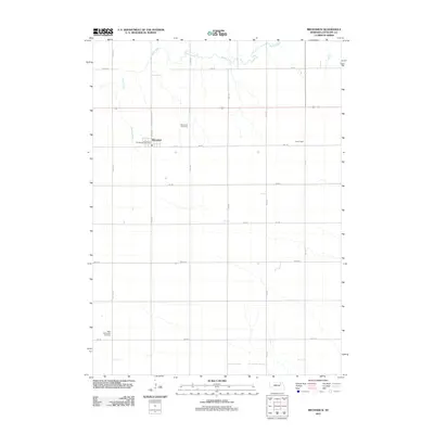
2011 Map of Brunswick
USGS Topo · Published 2011About this map
Brunswick serves as the central hub of this Antelope County landscape, situated along State Hwy Spur 2B. The town layout is clearly defined, featuring the Brunswick Post Office and local landmarks. The surrounding agricultural terrain is etched by the winding course of Bazile Creek, which meanders through the northern sections of the quadrangle. This map provides critical detail for researchers tracing local history, documenting the exact locations of the Brunswick Cemetery and the West Willowdale Cemetery in the southern reaches. The grid of rural roads, including 865 Rd and 527th Ave, reflects the organized section-line development typical of the Nebraska plains. Smaller locales like Copenhagen are also noted, providing a localized view of the county's settlement patterns in the early 21st century.
Find a feature on this map
21 named features on this map. Tap any name to fly to it.
Don’t see what you’re looking for? This feature index may not catch every label — zoom into the map to look around manually.
Map Details
Editions of this 2011 Brunswick Map
This is the sole edition of this map. No revisions or reprints were ever made.
Other maps of this area

1955 · Sioux City
USGS Topo · 1:250,000

1955 · O'Neill
USGS Topo · 1:250,000

1958 · Sioux City
USGS Topo · 1:250,000

1959 · O'Neill
USGS Topo · 1:250,000

1959 · Sioux City
USGS Topo · 1:250,000

1963 · Orchard NE
USGS Topo · 1:24,000

1963 · Neligh
USGS Topo · 1:24,000

1963 · Plainview
USGS Topo · 1:24,000

1963 · Brunswick
USGS Topo · 1:24,000
1963 · Tilden NE
USGS Topo · 1:24,000