
1963 Map of Brunswick
USGS Topo · Published 1964About this map
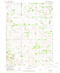
The agricultural landscape of Antelope County is anchored by the village of Brunswick and the Chicago Burlington and Quincy railroad, which cuts a sharp horizontal line across the northern third of this 1963 survey. The rural character of the era is defined by a dense network of one-room schoolhouses, including Copenhagen Sch, Baird Sch, and School No. 115, serving the surrounding townships of Eden, Bazile, and Ellsworth. These institutions, alongside Bethany Ch and the West Willowdale Cemetery, reveal the social fabric of a community built around the section-line roads and the waters of Bazile Creek. The map provides an intricate view of early 1960s land use, from the Gravel Pits in the northeast to the numerous irrigation wells scattered across Crawford and Custer townships, illustrating the intensive transition to modern groundwater-fed farming.
Find a feature on this map
21 named features on this map. Tap any name to fly to it.
Don’t see what you’re looking for? This feature index may not catch every label — zoom into the map to look around manually.
Map Details
Editions of this 1963 Brunswick Map
This is the sole edition of this map. No revisions or reprints were ever made.
Other maps of this area

1955 · Sioux City
USGS Topo · 1:250,000

1955 · O'Neill
USGS Topo · 1:250,000

1958 · Sioux City
USGS Topo · 1:250,000

1959 · O'Neill
USGS Topo · 1:250,000

1959 · Sioux City
USGS Topo · 1:250,000

1963 · Orchard NE
USGS Topo · 1:24,000

1963 · Neligh
USGS Topo · 1:24,000

1963 · Plainview
USGS Topo · 1:24,000
1963 · Tilden NE
USGS Topo · 1:24,000

1963 · Royal
USGS Topo · 1:24,000