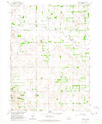
1963 Map of Tilden NE
USGS Topo · Published 1964About this map
The Antelope Co Pierce Co boundary divides this landscape of Nebraska farmsteads and rural schoolhouses during the early 1960s. The meandering course of Willow Creek dominates the northern half of the area, winding through a patchwork of agricultural sections where the township of Elm meets Mills. Local communal life is anchored by small, isolated landmarks such as Stark Valley Ch and several district schools, including Prairie Gem Sch and Hunt Sch. The terrain is shaped by subtle depressions and water features like Rowell Lake, illustrating the transition of the Missouri River Basin at a time when small rural institutions were still the primary focal points of the Nebraska countryside.
Find a feature on this map
13 named features on this map. Tap any name to fly to it.
Don’t see what you’re looking for? This feature index may not catch every label — zoom into the map to look around manually.
Map Details
Editions of this 1963 Tilden NE Map
This is the sole edition of this map. No revisions or reprints were ever made.
Other maps of this area

1955 · Sioux City
USGS Topo · 1:250,000

1958 · Sioux City
USGS Topo · 1:250,000

1959 · Sioux City
USGS Topo · 1:250,000

1963 · Pierce NW
USGS Topo · 1:24,000
1963 · Oakdale
USGS Topo · 1:24,000

1963 · Plainview
USGS Topo · 1:24,000

1963 · Brunswick
USGS Topo · 1:24,000

1963 · Foster
USGS Topo · 1:24,000

1963 · Meadow Grove
USGS Topo · 1:24,000
1963 · Tilden NW
USGS Topo · 1:24,000