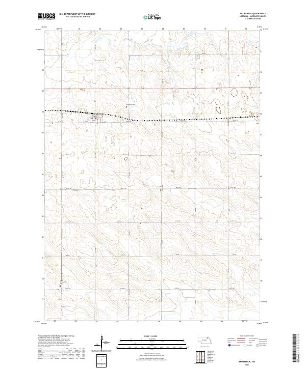
2021 Map of Brunswick
USGS Topo · Published 2021About this map
Brunswick serves as the primary hub of this northeastern Nebraska landscape, situated within a grid of section lines that define the agricultural character of Antelope County. The town site is laid out along a traditional street grid including 2nd St, 3rd St, and 4th St. The surrounding countryside is drained by the meandering course of Bazile Cr, which flows through the northern reaches of the quadrangle. Local history is anchored by the Brunswick Cem just north of town and the West Willowdale Cem located to the southwest. This modern survey reflects the enduring section-line road system, from 865 Rd down to 858th Rd, illustrating how the township and range boundaries of t27n r6w and its neighbors continue to organize the rural high plains.
Find a feature on this map
26 named features on this map. Tap any name to fly to it.
Don’t see what you’re looking for? This feature index may not catch every label — zoom into the map to look around manually.
Map Details
Editions of this 2021 Brunswick Map
This is the sole edition of this map. No revisions or reprints were ever made.
Other maps of this area

1955 · Sioux City
USGS Topo · 1:250,000

1955 · O'Neill
USGS Topo · 1:250,000

1958 · Sioux City
USGS Topo · 1:250,000

1959 · O'Neill
USGS Topo · 1:250,000

1959 · Sioux City
USGS Topo · 1:250,000

1963 · Orchard NE
USGS Topo · 1:24,000

1963 · Neligh
USGS Topo · 1:24,000

1963 · Plainview
USGS Topo · 1:24,000

1963 · Brunswick
USGS Topo · 1:24,000
1963 · Tilden NE
USGS Topo · 1:24,000