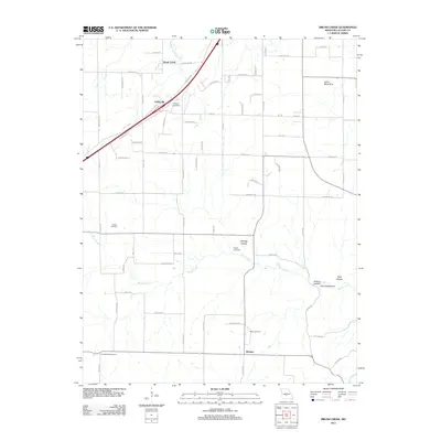
2011 Map of Brush Creek
USGS Topo · Published 2011About this map
Caffeyville and the small crossroads of Morgan anchor this rural landscape in the Missouri Ozarks during the early 21st century. The map reveals a deeply etched topography defined by numerous drainages, most notably Brush Creek and Goodwin Hollow Creek, which flow through a series of named hollows including Selvage Hollow and Wildcat Hollow. The network of local roads such as Potomac Dr and State Hwy W connects dispersed homesteads and farms, while unique geological features like Silver Mine Sink hint at the area's subterranean limestone characteristics.
Find a feature on this map
67 named features on this map. Tap any name to fly to it.
Don’t see what you’re looking for? This feature index may not catch every label — zoom into the map to look around manually.
Map Details
Editions of this 2011 Brush Creek Map
This is the sole edition of this map. No revisions or reprints were ever made.
Other maps of this area

1939 · Long Lane
USGS Topo · 1:62,500

1941 · Lebanon
USGS Topo · 1:62,500

1942 · Long Lane
USGS Topo · 1:62,500

1943 · Lebanon
USGS Topo · 1:62,500

1946 · Niangua
USGS Topo · 1:62,500

1948 · Niangua
USGS Topo · 1:62,500

1954 · Springfield
USGS Topo · 1:250,000

1956 · Rader
USGS Topo · 1:24,000
1956 · Grovespring
USGS Topo · 1:24,000

1958 · Springfield
USGS Topo · 1:250,000