
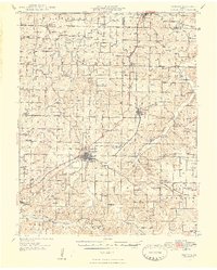
1948 Map of Niangua
USGS Topo · Published 1948About this map
The St Louis and San Francisco RR corridor anchors this 1948 survey of Webster County, Missouri, linking the larger settlements of Marshfield and Niangua with smaller depots like Northview and Conway. The landscape is defined by the headwaters of several major regional river systems, including the Niangua River, the Osage Fork Gasconade River, and the James River. This hydrological complexity resulted in numerous crossings such as Johnston Ford and Bumgardner Ford before modern bridge infrastructure was fully established.
Find a feature on this map
87 named features on this map. Tap any name to fly to it.
Don’t see what you’re looking for? This feature index may not catch every label — zoom into the map to look around manually.
Map Details
Editions of this 1948 Niangua Map
2 editions found
Other maps of this area

1884 · Springfield
USGS Topo · 1:125,000

1884 · Bolivar
USGS Topo · 1:125,000

1886 · Springfield
USGS Topo · 1:125,000

1892 · Bolivar
USGS Topo · 1:125,000

1937 · Ozark
USGS Topo · 1:48,000

1939 · Fordland
USGS Topo · 1:62,500

1939 · Long Lane
USGS Topo · 1:62,500

1941 · Lebanon
USGS Topo · 1:62,500

1942 · Fordland
USGS Topo · 1:62,500

1942 · Long Lane
USGS Topo · 1:62,500