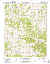
1979 Map of Brush Creek
USGS Topo · Published 1980About this map
Caffeyville and Huben sit along the diagonal corridor of the St-Louis-San Francisco railroad, which cuts through this Ozark landscape. The terrain is defined by complex drainage systems such as Brush Creek and its South Fork, as well as numerous hollows like Dog Hollow and Selvage Hollow. Much of the central and eastern portion of the sheet is dominated by the Osage Fork State Forest, a significant protected area within the Laclede and Webster county regions.
Find a feature on this map
32 named features on this map. Tap any name to fly to it.
Don’t see what you’re looking for? This feature index may not catch every label — zoom into the map to look around manually.
Map Details
Editions of this 1979 Brush Creek Map
This is the sole edition of this map. No revisions or reprints were ever made.
Other maps of this area

1939 · Long Lane
USGS Topo · 1:62,500

1941 · Lebanon
USGS Topo · 1:62,500

1942 · Long Lane
USGS Topo · 1:62,500

1943 · Lebanon
USGS Topo · 1:62,500

1946 · Niangua
USGS Topo · 1:62,500

1948 · Niangua
USGS Topo · 1:62,500

1954 · Springfield
USGS Topo · 1:250,000

1956 · Rader
USGS Topo · 1:24,000
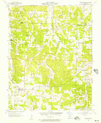
1956 · Grovespring
USGS Topo · 1:24,000

1958 · Springfield
USGS Topo · 1:250,000