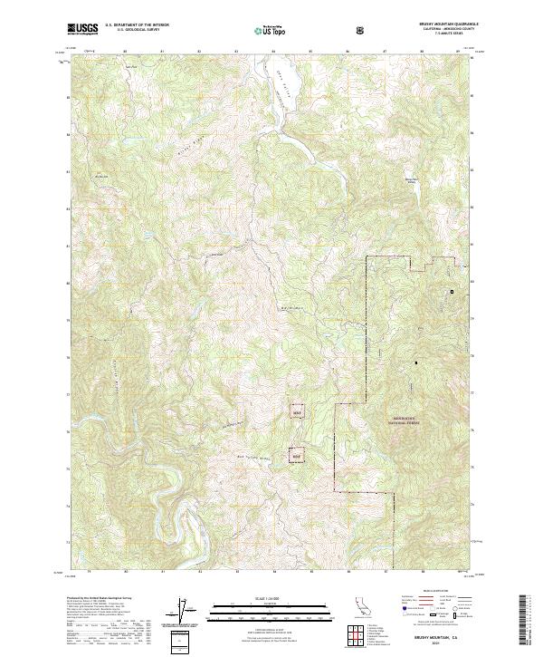
2021 Map of Brushy Mountain
USGS Topo · Published 2021About this map
EEL Wild and Scenic River carves a winding path through the southwest corner of this Mendocino County landscape, set within the western boundaries of the Mendocino National Forest. The terrain is defined by prominent north-south ridges including English Ridge and Bright Ridge, which flank the high point at Brushy Mtn. The map reveals a remote geography of interior basins like Eden Valley and Deep Hole Valley, where the transition between high mountain peaks and narrow creek canyons dictates the movement of water toward the larger river system. Human activity is largely confined to the winding Hearst Willits Rd, which navigates the complex topography through points like Low Gap. This area serves as a critical watershed, with numerous named springs and seasonal drainages such as Buckhorn Spring and Twin Bridges Cr providing the lifeblood for the surrounding forest ecology.
Find a feature on this map
42 named features on this map. Tap any name to fly to it.
Don’t see what you’re looking for? This feature index may not catch every label — zoom into the map to look around manually.
Map Details
Editions of this 2021 Brushy Mountain Map
This is the sole edition of this map. No revisions or reprints were ever made.
Other maps of this area

1922 · Willits
USGS Topo · 1:62,500

1929 · Eden Valley
USGS Topo · 1:62,500

1942 · Willits
USGS Topo · 1:62,500

1943 · Pomo
USGS Topo · 1:62,500

1944 · Willits
USGS Topo · 1:62,500

1951 · Laytonville
USGS Topo · 1:62,500

1952 · Eden Valley
USGS Topo · 1:62,500

1957 · Ukiah
USGS Topo · 1:250,000

1960 · Ukiah
USGS Topo · 1:250,000

1960 · Potter Valley
USGS Topo · 1:62,500