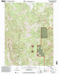
1996 Map of Brushy Mountain
USGS Topo · Published 2001About this map
Bright Ridge and English Ridge dominate this interior landscape of the Mendocino National Forest, where a complex network of canyons and high summits defines the terrain in the mid-1990s. The area is characterized by scattered water sources such as Summer Camp Springs and Brushy Lake, which provide critical reference points across the forested slopes. Prominent peaks like Brushy Mtn and Bard Mountain rise above deep drainages like Woman Canyon, illustrating the verticality of the northern Coast Range.
Find a feature on this map
26 named features on this map. Tap any name to fly to it.
Don’t see what you’re looking for? This feature index may not catch every label — zoom into the map to look around manually.
Map Details
Editions of this 1996 Brushy Mountain Map
This is the sole edition of this map. No revisions or reprints were ever made.
Other maps of this area

1922 · Willits
USGS Topo · 1:62,500

1929 · Eden Valley
USGS Topo · 1:62,500

1942 · Willits
USGS Topo · 1:62,500

1943 · Pomo
USGS Topo · 1:62,500

1944 · Willits
USGS Topo · 1:62,500

1951 · Laytonville
USGS Topo · 1:62,500

1952 · Eden Valley
USGS Topo · 1:62,500

1957 · Ukiah
USGS Topo · 1:250,000

1960 · Ukiah
USGS Topo · 1:250,000

1960 · Potter Valley
USGS Topo · 1:62,500