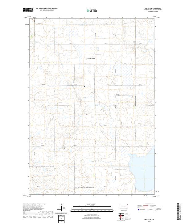
2021 Map of Bryant NE
USGS Topo · Published 2021About this map
Coteau des Prairies defines the rolling upland terrain of this Hamlin County landscape, characterized by a high concentration of small wetlands and prairie potholes. The map reveals a deeply rooted rural community, anchored by generational landmarks such as the New Hope Lutheran Cem and the Kellerton Zion Cem. These sites, along with the Pioneer Cem, offer significant value for genealogists tracing the early European settlement of the Dakota plains. In the southeastern corner, the waters of Lake Marsh provide a break in the grid of section lines and gravel roads, including New Hope Rd and Co Rd K. This area reflects the late-twentieth and early-twenty-first-century agricultural pattern of the region, where the original homesteading grid remains the primary framework for local travel and land management.
Find a feature on this map
29 named features on this map. Tap any name to fly to it.
Don’t see what you’re looking for? This feature index may not catch every label — zoom into the map to look around manually.
Map Details
Editions of this 2021 Bryant NE Map
This is the sole edition of this map. No revisions or reprints were ever made.
Other maps of this area

1953 · Watertown
USGS Topo · 1:250,000

1958 · Watertown
USGS Topo · 1:250,000

1969 · Hayti
USGS Topo · 1:24,000

1969 · Lake Norden
USGS Topo · 1:24,000

1969 · Pelican Lake
USGS Topo · 1:24,000

1973 · Bryant NE
USGS Topo · 1:24,000

1973 · Bryant
USGS Topo · 1:24,000
1973 · Gertson Slough
USGS Topo · 1:24,000
1973 · Grover
USGS Topo · 1:24,000

1973 · Vienna East
USGS Topo · 1:24,000
Featured Places
- Opdahl Township, SD
- Oxford Township, SD
- Brantford Township, SD
- Cleveland Township, SD
- Dixon Township, SD