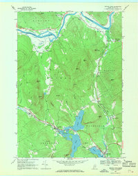
1967 Map of Bryant Pond
USGS Topo · Published 1969About this map
The Androscoggin River carves through the northern reaches of this Oxford County landscape, where the small settlements of Hanover and Rumford Corner sit along its banks. By the late 1960s, the southern half of the map reveals a corridor of transportation and industry defined by the Grand Trunk railroad line. This rail path connects the village of Locke Mills to the water-linked community at Bryant Pond, passing through a chain of glacial lakes including North Pond, South Pond, and Round Pond.
Find a feature on this map
56 named features on this map. Tap any name to fly to it.
Don’t see what you’re looking for? This feature index may not catch every label — zoom into the map to look around manually.
Map Details
Editions of this 1967 Bryant Pond Map
3 editions found
Other maps of this area

1911 · Bryant Pond
USGS Topo · 1:62,500

1914 · Bethel
USGS Topo · 1:62,500

1914 · Bryant Pond
USGS Topo · 1:62,500

1927 · Rumford
USGS Topo · 1:48,000

1930 · Rumford
USGS Topo · 1:62,500

1940 · Bethel
USGS Topo · 1:62,500

1941 · Bethel
USGS Topo · 1:62,500

1942 · Bryant Pond
USGS Topo · 1:62,500

1943 · Old Speck Mtn
USGS Topo · 1:62,500

1945 · Old Speck Mtn
USGS Topo · 1:62,500