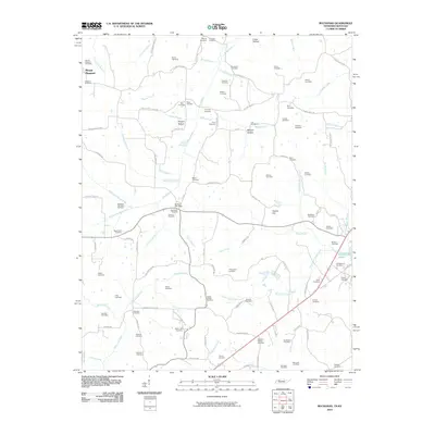
2010 Map of Buchanan
USGS Topo · Published 2010About this map
Mount Pleasant and the area surrounding Buchanan Post Office are characterized by a dense network of family cemeteries and rural homesteads at the edge of Kentucky Lake. This landscape, defined by the winding paths of the Blood River and Eagle Creek, reveals a deeply rooted community history through its many burial grounds, including the McGhee Old Slave Cemetery. The road network often follows the terrain of Crass Hollow and Owens Hill, connecting significant local landmarks like Heglar Chapel Cemetery and Bethel Cemetery. The convergence of the North Fork Blood River and South Fork Blood River illustrates the hydrologic patterns that have shaped the settlement and agriculture of this Tennessee-Kentucky border region for generations.
Find a feature on this map
116 named features on this map. Tap any name to fly to it.
Don’t see what you’re looking for? This feature index may not catch every label — zoom into the map to look around manually.
Map Details
Editions of this 2010 Buchanan Map
This is the sole edition of this map. No revisions or reprints were ever made.
Other maps of this area

1936 · Poplar Creek
USGS Topo · 1:24,000

1936 · Conyersville
USGS Topo · 1:24,000

1936 · Buchanan
USGS Topo · 1:24,000

1936 · Hazel
USGS Topo · 1:24,000

1936 · New Concord
USGS Topo · 1:24,000

1936 · Hamlin
USGS Topo · 1:24,000

1936 · Centerville Landing
USGS Topo · 1:24,000

1936 · Paris
USGS Topo · 1:24,000

1936 · Springville
USGS Topo · 1:24,000

1938 · Springville
USGS Topo · 1:24,000