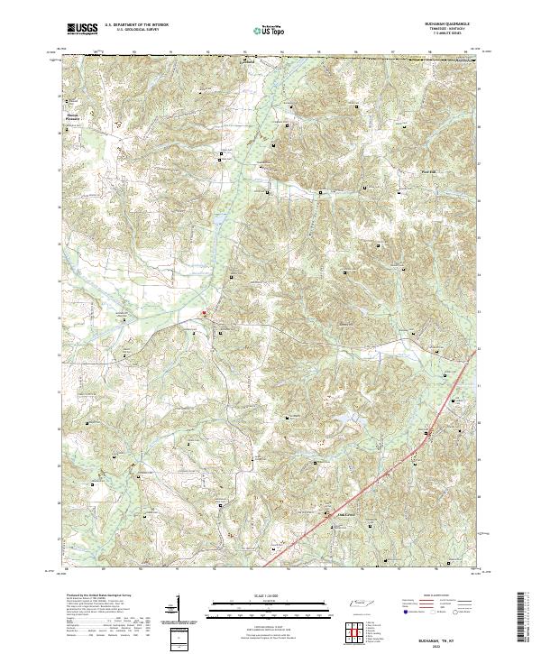
2022 Map of Buchanan
USGS Topo · Published 2022About this map
The Kentucky Tennessee state line divides this borderland between Henry County and Calloway County, where the low-lying drainage basins of the Blood River and Eagle Creek define the landscape. Settlement patterns follow the high ground between these drainage networks, notably at Freeland and Oak Grove. This territory is exceptionally dense with family-named burial grounds, providing a significant map for genealogical research. Sites like the Old Soldiers Cem and the Heglar Chapel Cem sit among dozens of others including the Valentine Cem and Moody Rowlett Cem. The modification of the natural hydrology is evident in the channelization of the N Fork Blood River Drainage Ditch and its various tributaries, a common practice in this era to manage the bottomlands for agricultural use.
Find a feature on this map
135 named features on this map. Tap any name to fly to it.
Don’t see what you’re looking for? This feature index may not catch every label — zoom into the map to look around manually.
Map Details
Editions of this 2022 Buchanan Map
This is the sole edition of this map. No revisions or reprints were ever made.
Other maps of this area

1936 · Poplar Creek
USGS Topo · 1:24,000

1936 · Conyersville
USGS Topo · 1:24,000

1936 · Buchanan
USGS Topo · 1:24,000

1936 · Hazel
USGS Topo · 1:24,000

1936 · New Concord
USGS Topo · 1:24,000

1936 · Hamlin
USGS Topo · 1:24,000

1936 · Centerville Landing
USGS Topo · 1:24,000

1936 · Paris
USGS Topo · 1:24,000

1936 · Springville
USGS Topo · 1:24,000

1938 · Springville
USGS Topo · 1:24,000